Another Weekend…Another Nor’easter.
If you've stepped outside you know it's still windy and cold. We will see off and on flurries. As the low moves to the east; the region will dry out over the next 12-18 hours. This is all thanks to the strong Canadian high pressure area. Today the Heart Land will be dealing with a Blizzard. Also Severe weather will be on tap for Texas into the Southeast Today and tomorrow. The system bringing the blizzard to the Plains will move into the Great Lakes and weaken. Even so, the Upper Lakes will still see quite a bit of snow tomorrow. Some of the moisture will make it into the Mid-Atlantic and Northeast tomorrow night. It should be cold enough around here for a mix of snow, sleet and /or rain. But precipitation amounts will be on the light side.
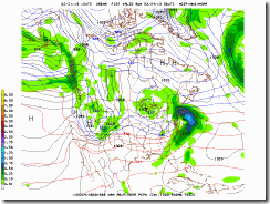
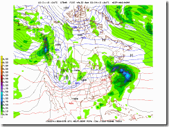
Over the weekend, another storm will take shape in the Southeast. On Saturday, moisture from the South Atlantic states should stream up along the coast, energy from the weakening system will transfer into the area. The storm system that develops will strengthen off the Middle Atlantic. Right now, it looks to become a significant coastal storm by late Saturday This growing storm should cause rain in Philadelphia and New York City in Saturday, then transition into a snow producer for much of New England by Saturday night/early Sunday.
A major key to what happens over the Northeast this weekend; will have to do with an arctic disturbance and a polar disturbance; how these interact will determine how fast the coastal intensifies. If we see a very week interaction the storm will go well east on New England. On the other hand, if there's a lot of interaction the storm could bomb, bringing New England a sufficient snowstorm. Each of these disturbances are fairly intense, and entering into an area favorable to storm development.
Often a strong Nor'easter will draw in its own cold air, So the merging of the cold air will disturbances, and cold air/land of the Northeast, will contrast with the Gulf Stream and much warmer ocean, increasing instability, this boundary would also aid in intensification.
So I'm thinking this will be Northeast Storm.
The Models:
The models are in fairly good agreement on this storm.

NAM

GFS

EURO

UKMET
Here is how things look like on the Euro. But the other models are quite similar.

We could be dealing with a lot of severe weather in the Southeast. From here the disturbance will move to southern Mid Atlantic coast.

Here is where the energy transfer from the weakening storm over the Great Lakes will take place.

Everyone is interested in how much snow will fall. That is not completely clear at this time. Where the coastal front sets up will be a major factor in who sees what. The mixing line could give Eastern and Southern New England a rain/snow/mix. whereas areas north of the Massachusetts Turnpike into Southern Maine and parts of Western New England well see more in the way of heavy snow. There is a shot that parts of Eastern New York State could see plowable snow as well. Central New York State will be on the outside fringe. Areas like the Mid Atlantic, New Jersey, New York City, Long Island, and Rhode Island look to see mostly rain. However, any wobble east or west would have a major impact on who sees heavy snow.
This may not be the last storm we have to deal with over the next few weeks...The pattern is active and it is full of possible storms.
And please don’t ask for what’s in my backyard forecast, it’s just too early to know.
That’s all for now, please follow my Facebook weather page for other updates.
Paul
Over the weekend, another storm will take shape in the Southeast. On Saturday, moisture from the South Atlantic states should stream up along the coast, energy from the weakening system will transfer into the area. The storm system that develops will strengthen off the Middle Atlantic. Right now, it looks to become a significant coastal storm by late Saturday This growing storm should cause rain in Philadelphia and New York City in Saturday, then transition into a snow producer for much of New England by Saturday night/early Sunday.
A major key to what happens over the Northeast this weekend; will have to do with an arctic disturbance and a polar disturbance; how these interact will determine how fast the coastal intensifies. If we see a very week interaction the storm will go well east on New England. On the other hand, if there's a lot of interaction the storm could bomb, bringing New England a sufficient snowstorm. Each of these disturbances are fairly intense, and entering into an area favorable to storm development.
Often a strong Nor'easter will draw in its own cold air, So the merging of the cold air will disturbances, and cold air/land of the Northeast, will contrast with the Gulf Stream and much warmer ocean, increasing instability, this boundary would also aid in intensification.
So I'm thinking this will be Northeast Storm.
The Models:
The models are in fairly good agreement on this storm.

NAM

GFS

EURO

UKMET
Here is how things look like on the Euro. But the other models are quite similar.

We could be dealing with a lot of severe weather in the Southeast. From here the disturbance will move to southern Mid Atlantic coast.

Here is where the energy transfer from the weakening storm over the Great Lakes will take place.

Everyone is interested in how much snow will fall. That is not completely clear at this time. Where the coastal front sets up will be a major factor in who sees what. The mixing line could give Eastern and Southern New England a rain/snow/mix. whereas areas north of the Massachusetts Turnpike into Southern Maine and parts of Western New England well see more in the way of heavy snow. There is a shot that parts of Eastern New York State could see plowable snow as well. Central New York State will be on the outside fringe. Areas like the Mid Atlantic, New Jersey, New York City, Long Island, and Rhode Island look to see mostly rain. However, any wobble east or west would have a major impact on who sees heavy snow.
This may not be the last storm we have to deal with over the next few weeks...The pattern is active and it is full of possible storms.
And please don’t ask for what’s in my backyard forecast, it’s just too early to know.
That’s all for now, please follow my Facebook weather page for other updates.
Paul


